

CYA Snapper · iPhone
Evidence-grade locate documentation.
CYA Snapper is a camera built for utility locators and pipeline field crews who have to document their marks before a dig. Open the app, shoot, and every photo is recorded with the details that matter if a line is ever struck.
$9.99 USD one time· no subscription
Built by someone who has run thousands of locate tickets and ran the new-hire training for locators, alongside a company with 30 years in pipeline construction and inspection leadership. The documentation problem here is not theoretical. It is what the work gets judged on after everyone has gone home.
The problem
A line gets struck weeks after you marked it. The question is what was on the ground when you left, and the answer is a photo in a camera roll with no accuracy reading, no bearing, and nothing to show it has not been touched since.
The documentation is only worth what it can demonstrate later.
Who it is for
Utility locators, damage prevention crews, pipeline field techs, and the inspectors who follow them. Anyone whose work is judged after the fact by what they can produce.
Who it is not for
People looking for a consumer camera with a location watermark. This is built around work tickets, accuracy thresholds, and an evidence record, and it will feel like overkill for anything else.
Anyone expecting it to locate a utility. It documents what you marked. It does not find the line.
Anyone who needs a legal determination. The app records and hashes what your camera captured. Whether that satisfies a court, a regulator, or a claim is decided by them, not by an app and not by us.
Android users. This is iPhone only.
What every capture records
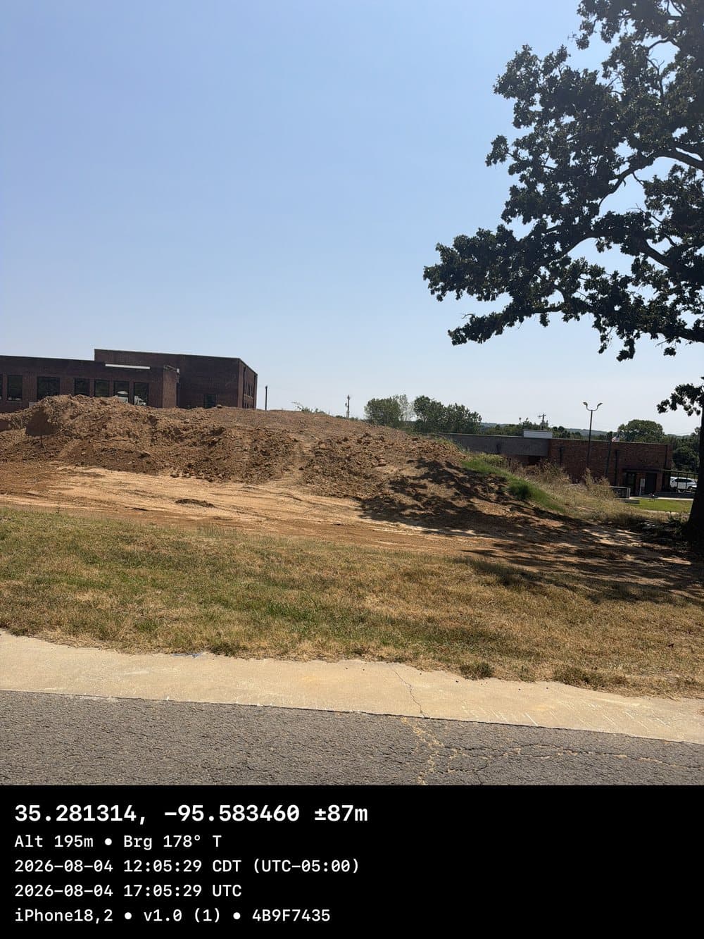
- GPS coordinates with an accuracy reading, altitude, and compass bearing
- Device time at the location fix and at the shutter, in local time and UTC
- A SHA-256 hash of the original photo as captured, so you can show it is unchanged
- The device, OS, and app version
What you actually hand over
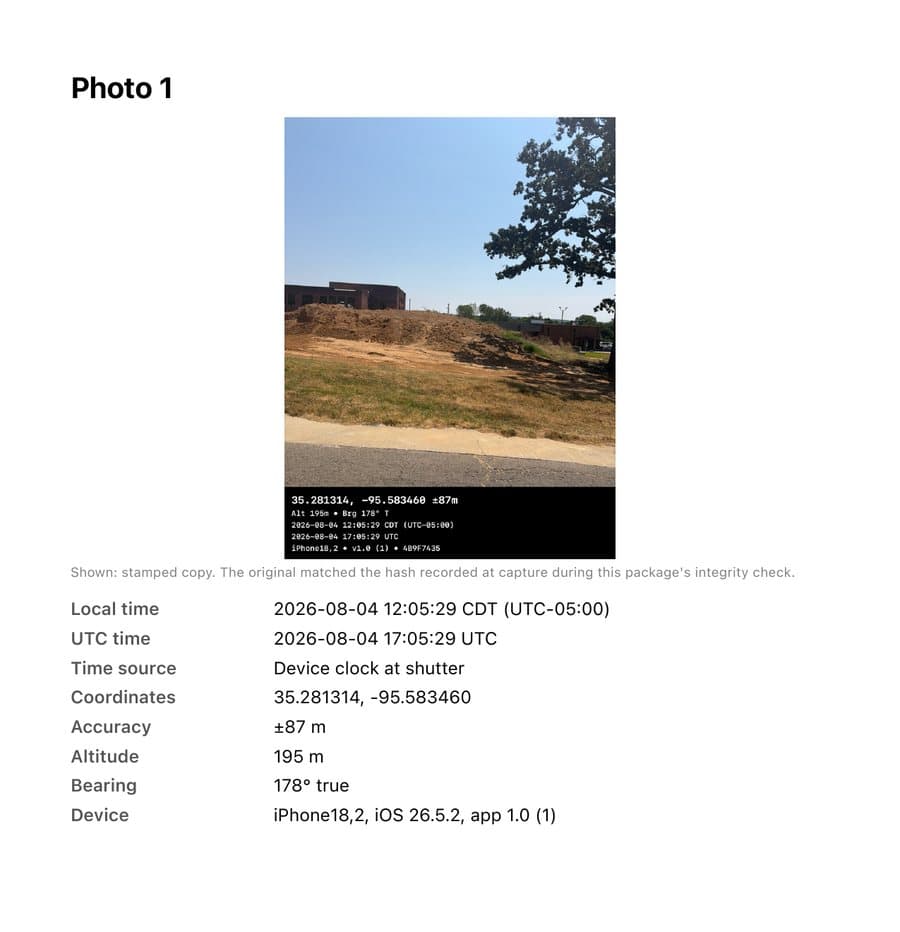
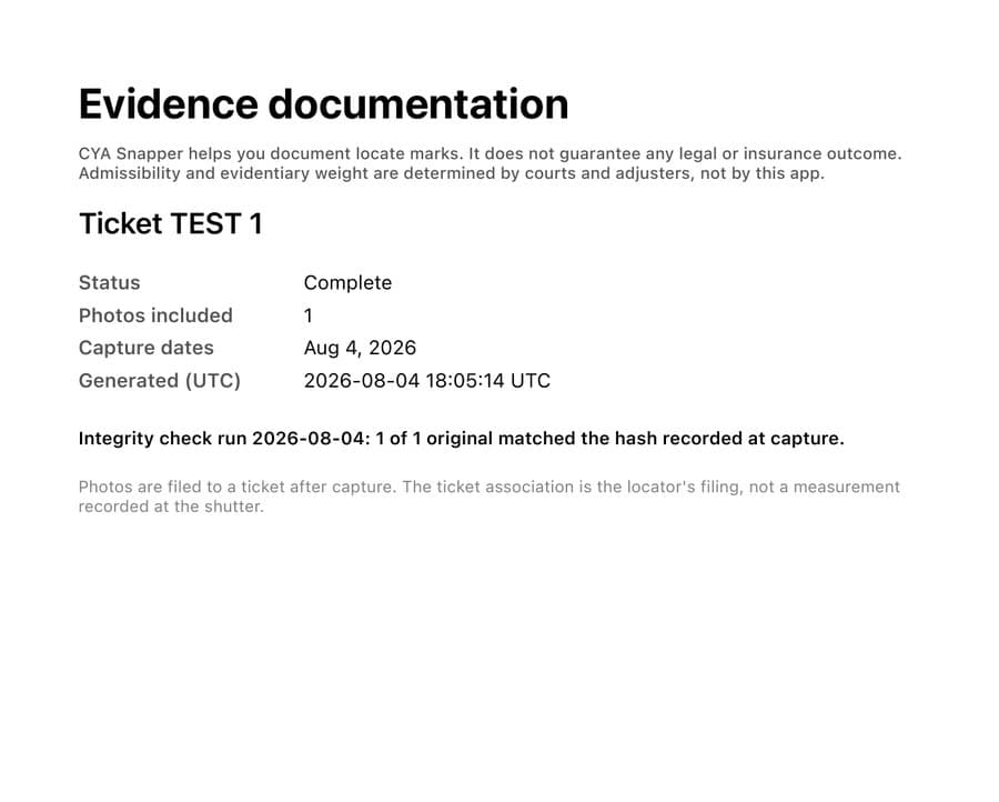
Export a ticket and you get an evidence package: a cover stating the integrity check result, a map of where each photo was taken, and a page per photo carrying the stamped image, the full record, and the SHA-256 of the original.
Tamper-evident, and checkable
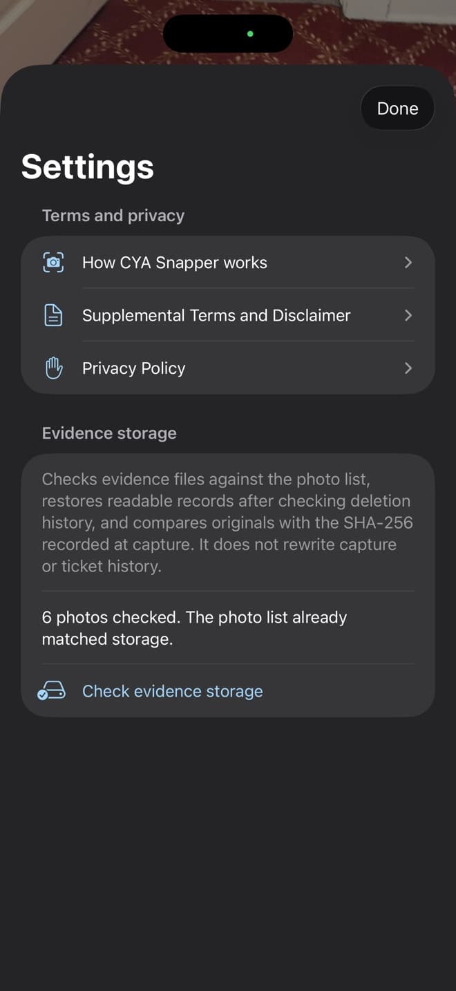
Each original is hashed with SHA-256 at capture. The app compares the stored files against that recorded hash on demand, checks the photo list against what is actually in storage, and restores readable records without rewriting capture or ticket history.
That is the difference between saying a photo is unchanged and being able to show it.
CYA Snapper helps you document your locates. It does not make any legal determination. Admissibility is decided by a court, not by an app.
Built around the ticket, not the camera roll
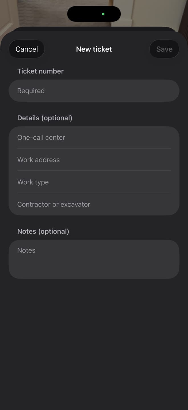
Photos file to a work ticket, with the one-call center, work address, work type, and the contractor or excavator on the job. The fields are the ones already on the paperwork, so filing is recall rather than translation.
Shoot everything first. File at the truck when your hands are free.
Built for the field
- Horizontal accuracy is visible before you shoot. Green means under 5 meters reported accuracy
- The shutter is never blocked by paperwork. Shoot first, file to a ticket at the truck
- Reduced accuracy, no fix, and simulated location are flagged loudly, on the photo and in the record
- With Photos access allowed, a stamped copy is saved to your library so you keep your own
Your data stays yours
No account and no subscription. Ironclad has no servers and never receives your data. No tracking and no analytics.
Evidence packages leave your device only when you export them. Two things are worth naming plainly rather than leaving in the fine print: drawing the optional map page in a package asks Apple Maps for a map image using the photo coordinates, and the stamped copy saved to your Photos library follows your own Photos and iCloud settings.
A 30-second look at CYA Snapper
Actual product screenshots with captions. This is a silent screenshot walkthrough, not a live screen recording.
Read the walkthrough transcript
- Ticket-based field photo documentation.
- Keep photos tied to a work ticket.
- Review location accuracy, bearing and timestamps.
- Inspect the export and its integrity result.
- A hash checks the file. It does not prove an event or decide legal admissibility.
- $9.99 USD. iOS 18.0+. Review Maps, export and Photos/iCloud privacy details.
Straight answers
- What does it cost, and which iPhone version does it need?
- $9.99 USD one time. iPhone, iOS 18.0 or later. Check the App Store for your region's current price and compatibility.
- Does it work without cell service?
- Yes. Capture, hashing, and filing to a ticket all happen on the device. GPS is satellite based and does not need a data connection, though a fix can take longer in the open with no assist data.
- What happens if there is no GPS fix?
- The photo still saves and is stamped NO GPS FIX. Reduced accuracy and simulated location are flagged the same way, on the photo and in the record. The app never quietly records a position it is not confident in.
- Where do my photos go?
- Ironclad does not receive your photos. You choose when to export them and where to send them. Other network and storage behavior matters too: drawing the optional map page in an evidence package asks Apple Maps for a map image using the photo coordinates, and the stamped copy saved to your Photos library follows your own Photos and iCloud settings.
- How does the hash actually help me?
- Each original is hashed with SHA-256 at capture. Later you can have the app compare the stored file against that recorded hash, so you can show the photo is the same one the camera produced. It demonstrates the file is unchanged. It does not prove what the photo depicts.
- Is there a subscription?
- No subscription and no upsells. There is no account to create and nothing to log into.
- Is there an Android version?
- Not currently. CYA Snapper is iPhone only.
A practical guide
Built by someone who ran the tickets
This was not designed from a product spec. It came from running thousands of locate tickets and then training the people who would run them next. Every field this app records is one that mattered when a locate was questioned later, and nothing is here because it demoed well.
iPhone, iOS 18.0 or later · $9.99 USD one time